Driving Routes
Discovery Trail: Goulburn River
- Length
- 171 kms (circuit)
- Driving Time
- 3.5 hrs (circuit)
- Road Conditions
- Highway, narrow sealed roads, unsealed roads (dry weather only)
- Start and Finish
- Merriwa (or Sandy Hollow)
- Snapshot
- A highly varied circuit of the spectacular Goulburn River country, combining escarpment and riverside scenery with pleasant rural countryside and vineyards. Takes in part of the main Greater Blue Mountains Drive.
- Highlights
- Lees Pinch Lookout, the Bylong Valley and Coxs Gap.
- Alerts!
- Narrow, winding roads. Some unsealed roads are dry weather only.
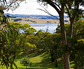
From Merriwa, take the Golden Highway west for 8km, then turn left into Ringwood Road. Heading south-west a huge panorama opens out, over the sandstone bushland to distant peaks of Wollemi National Park. After some distance through the bush, stop for a rest and a view at Lees Pinch before descending steeply to cross the Goulburn River. On the valley floor, turn left onto Wollar Road and follow it through the impressive farming valley to the junction with Bylong Valley Way on the left. Bylong village and store - just a short distance straight on - is worth a visit, but to continue the drive turn left.
Pass over the low Murrumbo Gap into the basalt-rich Murrumbo Valley and re-enter the bush of Wollemi National Park on the other side. Here the delightful Honeysuckle Creek Picnic Area is a great place for a rest before the steep (and spectacular) crossing of Coxs Gap. Down in the valley again, the road winds along the scenic Goulburn River, where the next pleasant roadside stop is Phipps Cutting. The Bylong Valley Way continues to Sandy Hollow, where the discovery trail turns left to follow the Golden Highway (and the main Greater Blue Mountains Drive) through Gungal and back to Merriwa.


